
DeltaQuad is a leading developer of fully electric VTOL fixed-wing unmanned aerial vehicles (UAVs) for enterprise, government and defense applications. Made in the Netherlands, our versatile platforms provide unmatched operational capabilities and are designed to excel in even the toughest environments.
Innovation is one of our most essential core values, and we integrate the latest in drone technology into our solutions to ensure success for our customers in a constantly-changing industry.
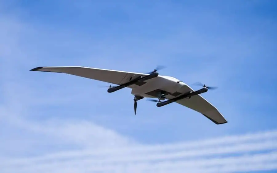
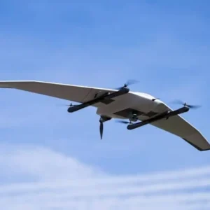
The DeltaQuad Evo platform
DeltaQuad Evo is an advanced long-range UAS platform offering an industry-leading endurance of up to 8 hours with a range of up to 270 km. Engineered to stringent military-grade standards, it has been constructed with the highest-quality carbon, kevlar, and fibreglass, ensuring the utmost in longevity and performance in harsh operating conditions.

Evo features a highly aerodynamic wing shape that ensures maximum manoeuvrability and flight efficiency. With fully autonomous capabilities, it can undertake a range of complex mission types with minimal human intervention. The system is easy to unpack and assemble, and pilots can be airborne and operational in just five minutes.

Modular dual-payload capabilities
Evo’s modular dual-payload system allows you to equip two different sensors for multi-mission versatility, or install an additional battery for extended flight time. A wide variety of payloads can be installed, allowing you to future-proof your aircraft and meet evolving mission requirements.
 Options include:
- RGB & thermal imaging cameras
- LiDAR scanners
- Multispectral imagers
- EO/IR surveillance gimbals
- Automated aerial payload deployment systems
- Customized & 3D-printed payload attachment kits
DeltaQuad Evo Models
Evo is available in a number of specialized models that cater to specific mission profiles.
Evo Enterprise
Evo Enterprise is specifically targeted towards commercial applications, providing everything you need for mapping, surveying, inspection and monitoring. With up to 30km radio range and 8 hours of flight time, the highly efficient platform allows you to accomplish much more without needing to land.

The modular payload bay allows you to integrate multiple sensors, including RGB, multispectral, LiDAR, and infrared, to create high-precision geo-referenced maps and detailed terrain profiles. NTRIP RTK corrections can be utilized for real-time accuracy, with PPK for enhanced post-processing capabilities.

Evo Stealth
 The Evo Stealth variant features a low acoustic signature and highly efficient aerodynamic design, making it ideal for mission-critical covert operations. Delivering over twice the range and endurance of comparable stealth drone systems, it has been engineered for Deploy-and-Forget operations, using a cost-effective radio link that can be switched off when missions begin or at key waypoints.
The aircraft includes a sophisticated CRPA-based anti-jamming GNSS system that can resist up to 7 active GPS jammers. It can also navigate accurately, take off, and land in GPS-denied environments by using inertial and vision-based navigation.
Applications
 Agriculture & Forestry
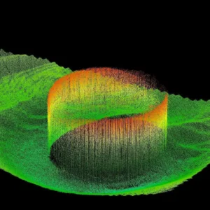
The DeltaQuad Evo VTOL UAS is an ideal platform for agriculture and forestry, capturing data with state-of-the-art sensors and providing results that can be used for critical actionable intelligence. Orthomosaic maps and 3D models can be created with cameras up to 61 MP in resolution, and the Micasense RedEdge MX provides multispectral imaging for precision information on plant health.
More Info: Mapping Drones for Agriculture & Forestry
 Geospatial
The DeltaQuad Evo delivers centimeter-level accurate high resolution geospatial information. Acquire GIS data and imagery from a turn-key UAV solution that can cover large areas and takeoff and land anywhere. The DeltaQuad Evo will take off, survey the indicated area and return for landing completely autonomous.
More Info: Surveying Drones for Geospatial
 Oil & Gas
The DeltaQuad Evo can autonomously survey over 100km of pipeline and monitor remote sites at up to 30km away, detecting defects, leaks, corrosion and hazards with high resolution thermal and RGB video. The system can also fly predefined corridors with automatic terrain following.
More Info: Drone Solutions for Oil and Gas
 Utilities & Infrastructure
In a single flight, the DeltaQuad Evo can survey over 100km of power lines, water pipes railways or roads, or over 1000 ha of solar panels, providing remote monitoring at distances of up to 30 km away. Combined thermal and RGB video capabilities provide damage, fault and hazard detection as well as water leak and vegetation monitoring.
 Mining & Construction
The DeltaQuad Evo provides a range of advantages for mining and construction applications, delivering high resolution geospatial information with centimetre-level accuracy. This information can be used to create orthomosaic maps and 3D quarry models, calculate volume stockpiles, and more.
More Info: VTOL Drones for Mining and Construction
 Security & Defense
The DeltaQuad Evo is highly suited to aerial reconnaissance missions, providing live thermal and HD RGB video with a transmission range of up to 30 km, or unlimited range using a mobile network. The platform’s VTOL operation allows it to be deployed in almost any environment, with a setup time of just two minutes.
More Info: Surveillance Drones for Defense and Security
 Humanitarian Deliveries & Wildlife
The DeltaQuad Evo can transport goods to and from remote areas, with the ability to take off and land even in highly confined terrain. With a payload capacity of 3 kg, it can be used to deliver vital cargo including medical supplies, blood samples and nutritional aid.
The DeltaQuad Evo provides a multitude of essential capabilities for rangers and wildlife professionals. The RGB and thermal imaging camera can be used for anti-poaching missions, to detect and observe wildfires, to track animals and to provide aerial reconnaissance in dangerous areas.
More Info: Drones for Humanitarian and Wildlife
Reviews
There are no reviews yet.