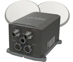
SBG SYSTEMS is a leading supplier of MEMS-based ITAR Free inertial motion sensing solutions.From miniature inertial navigation systems to high accuracy INS GPS, SBG SYSTEMS sensors offer a unique balance of price – size – performance for unmanned systems navigation.
SBG Systems offers a complete line of inertial sensors based on the state-of-the-art MEMS technology, such as Attitude and Heading Reference System (AHRS), Inertial Measurement Unit (IMU), and embedded GPS Inertial Navigation System (INS/GPS). Combined with cutting-edge calibration techniques and advanced embedded algorithms, our inertial sensors are ideal solutions for unmanned vehicle control, antenna tracking, camera stabilization, and surveying applications.
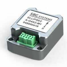
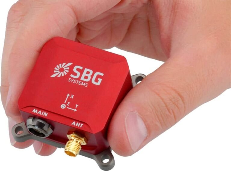
Ellipse Micro Series – IMU & AHRS
Smallest Size High-Performance IMU and AHRS for Unmanned Applications
 High accuracy (0.1° Roll/Pitch) industrial grade micro inertial sensors with the smallest form factor:
- Extremely light weight at 10 grams
- Industrial grade high-end gyroscopes and accelerometers
- Extended calibration, from -40 to +85°C for constant behaviour in a wide range of environments
- Fusion with GNSS receiver for robust and accurate position, heave and heading output
- Specific motion algorithms fine-tuned for land systems such as UGVs and autonomous driving
- Cost-effective – designed for volume projects.
 |
 |
|
| Ellipse Micro IMU | Ellipse Micro AHRS | |
| Calibrated IMU data | ✔️ | ✔️ |
| Roll, Pitch, Heading | X | ✔️ |
| Heave | X | ✔️ |
| Navigation | X | X |
Ellipse Series – Industrial-Grade Inertial Sensors
Robust, high-performance inertial sensors for small unmanned systems
 3rd Generation, ITAR-free miniature inertial sensors with an extremely rugged design, cutting-edge sensors, and advanced algorithms:
- 0.05° RMS accuracy
- Very Low Noise Gyroscopes
- Embedded 64Bit microprocessor
- Integrated GPS + GLONASS/BEIDOU receiver
- Accepts DGPS corrections and Odometer inputs
- High-level algorithms for vibrations and magnetic disturbances handling.
 |
 |
 |
 |
|
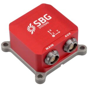
| Ellipse-A Orientation + Heave Motion Sensor |
Ellipse-E INS with your own external GNSS receiver |
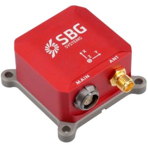
Ellipse-N Single Antenna RTK INS with integrated GNSS receiver |
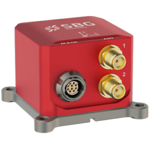
Ellipse-D Dual Antenna RTK INS with integrated GNSS receiver |
|
| Roll and Pitch | 0.1°over 360° | 0.05° RTK | 0.05° RTK | 0.05° RTK |
| Heading | 0.8° Heading (Internal Magnetometers) | Magnetic or GNSS Heading | 0.2° Heading (RTK high dynamics) | 0.2° Heading (Dual Antenna RTK GNSS) |
| Heave | 5 cm Real-time Heave | 5 cm Real-time Heave | 5 cm Real-time Heave | 5 cm Real-time Heave |
| Navigation | X | Navigation with external GNSS receiver | L1/L2 GNSS receiver 1 cm RTK GNSS Accuracy |
L1/L2 GNSS receiver 1 cm RTK GNSS Accuracy |
| Post-Processing | X | ✔️ | ✔️ | ✔️ |
Quanta UAV Series
High-accuracy INS/GNSS for UAV-based Surveying Solutions
The Quanta series is a high-accuracy GNSS-aided Inertial Navigation System designed for UAV and land-based surveying solutions.
- Lightweight and low-power
- Extended Kalman Filter fuses inertial and GNSS data for the highest performance in the most challenging conditions
- Direct geotagging of point cloud in real time for more accuracy in post-processing
- Direct georeferencing eliminates need for ground control points and reduces need for overlapping
- Also ideal as a high-end navigation solution for UAV autopilots.
Tactical-Grade IMU
Pulse-40
Miniature tactical-grade 6 DoF IMU for UAVs & unmanned systems
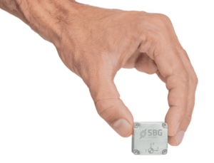 The Pulse-40 is a tactical-grade inertial measurement unit designed to provide robust high-precision stabilization and navigation under even the harshest of conditions. Incorporating state-of-the-art MEMS three-axis accelerometers and gyroscopes in a unique redundant design, it features extremely low VRE (Vibration Rectification Error), and is ideal for high frequency dynamics and high-vibration environments.
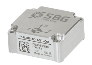 Weighing just 12 grams and drawing 0.3W, the Pulse-40’s extremely low SWaP footprint makes it ideal for a variety of drones and robotic platforms. The unit features redundant sensor integration and embedded Continuous Built-In-Test, providing the utmost in data reliability for critical applications.
Main Features:
- Best SWaP-C: 12 grams, 0.3W Power consumption
- Ultra-Low Noise Gyro (0.08°/√h) and excellent Gyro Bias Instability (0.8°/h)
- High-precision Accelerometers (6µg)
- Low Vibration Rectification Error: Shocks and vibrations MIL-STD 810 qualified
- High Bandwidth (480Hz) and High data rate (2KHz)
- Highly Tested and Calibrated from -40°C to 85°C
- No export restrictions
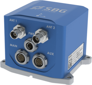
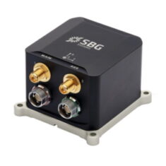
Ekinox Series
Mid Accuracy AHRS and INS/GNSS for High Performance Unmanned Systems
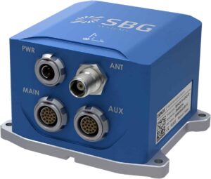 Mid accuracy (0.02° attitude) in a cost-effective and compact package:
- Fusion with Odometer, GNSS and DVL for the best accuracy
- Internal L1/L2 Survey-grade GNSS receiver
- Low latency, high output rate for demanding applications
- Post-processing feature for Surveying applications
- Motion profiles tuned for UAVs, UGVs, and UUVs specific dynamics
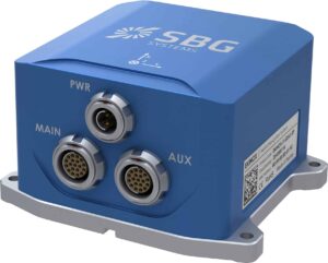 |
 |
 |
 |
|
| Model | Ekinox-A | Ekinox-E | Ekinox-D | Ekinox-Micro |
| Roll, Pitch, Heading | ✔️ | ✔️ | ✔️ | ✔️ |
| Heave | ✔️ | ✔️ | ✔️ | ✔️ |
| Navigation | X | ✔️ Connection to external GPS | ✔️ Integrated dual-antenna GNSS receiver | ✔️ Integrated dual-antenna GNSS receiver |
High Accuracy INS
Apogee Series
High-accuracy AHRS and INS/GNSS for Survey Unmanned Systems
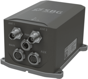 The Highest accuracy (0.005° orientation) in a cost-effective, small INS package:
- Fusion with Odometer, GNSS and DVL for the best accuracy
- Internal L1/L2/L5 Survey-grade GNSS receiver
- Low latency, high output rate for demanding applications
- Post-processing software for Surveying applications
- Motion profiles tuned for UAVs, UGVs, and UUVs specific dynamics
Post-Processing Software
Qinertia
INS/GNSS post-processing software
Qinertia is our next-generation GNSS/INS post-processing software, with access to offline, always up-to-date RTK corrections from more than 7,000 base stations located in 164 countries.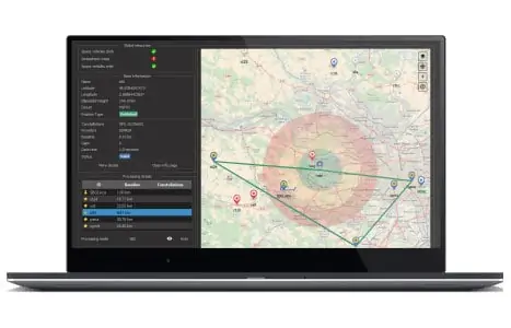
Designed to support all GNSS receivers and third-party IMUs, it features an advanced proprietary tight coupling algorithm designed to deliver the highest accuracy and maximize RTK availability.
The software also features Virtual Base Station (VBS) functionality, creating a virtual network around your project and providing centimetre-level accuracy even for corridor mapping, locations far from base stations, and in poorly covered RTK areas.
Qinertia is available in four different tiers:
- Qinertia Pro – full-featured GNSS/INS post-processing solution supporting all SBG sensors and third-party IMUs
- Qinertia Lite – economical solution for UAV and land-based projects, supporting all SBG sensors
- Qinertia UAV – designed for UAV-based surveying and photogrammetry applications
- Qinertia GNSS – static and kinematic GNSS data processing only, supporting any receiver





Reviews
There are no reviews yet.