
ABRIS Design Group is a European designer and manufacturer of advanced UAV and unmanned systems solutions that are designed to undertake a wide range of challenging missions for government, defence and commercial clients.
The company’s products have been fielded in the world’s toughest environments, including deserts, mountains and even Antarctica, and have undertaken over 10,000 real-world operations to date.
Photo Reconnaissance UAVs
Sentinel
Catapult-launched NATO Class 1 tactical ISR UAV

Sentinel is a long-range fixed-wing UAV platform that is designed to undertake long-duration ISTAR missions in challenging and contested environments. Equipped with advanced anti-jamming GNSS and resilient communications and telemetry transmission systems, it ensures secure and uninterrupted real-time intelligence for superior decision-making.
The catapult-launched unmanned aircraft can be transported by car and operated by a team of two people.
- 180 min max endurance
- Up to 200 km flight distance
- 2 kg max payload

A complete Sentinel kit includes two UAVs, two ground control stations, a ground antenna station, a launching system, and a variety of additional accessories.
Equipment:
- Fujifilm GFX100RF EO camera:
EO Zoom: 1x optical, 2.8x digital crop
EO Resolution: 11648 × 8736 px - Sony LR1 EO camera:
EO Zoom: Depends on lens; Clear Image Zoom: up to 2x
EO Resolution: 9504 × 6336 px
Atlas
Hand-launched NATO Class 1 tactical ISR UAV

Atlas is a lighter version of the Sentinel ISTAR platform, featuring hand-launching capabilities for a smaller operational footprint and rapid deployment. The highly portable system can be transported in a backpack and operated by a crew of one or two people.
- 150 min max endurance
- Up to 140 km flight distance
- 1 kg max payload

A complete Atlas kit includes two UAVs, two ground control stations, a ground antenna station, and a variety of additional accessories.
Equipment:
- Sony LR1 EO camera:
EO Zoom: Depends on lens; Clear Image Zoom: up to 2x
EO Resolution: 9504 × 6336 px
Tactical VTOL ISTAR / Signal Relay Platform
Scout
Class 1 multirotor UAV for ISTAR & signal relay

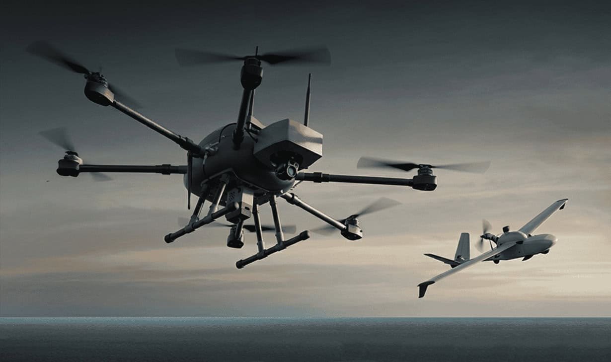
The Scout is a versatile multirotor drone platform that is ideal for short-range missions such as ISTAR and signal relay for FPV drones and secure communications. With a controlled radius range of up to 12km, it is highly suited to scenarios requiring VTOL operation with relatively small areas of coverage.
- 60 min max endurance
- Up to 12 km controlled radius range
- 1.8 kg max payload

The complete kit includes two Scout drones with NextVision X80 cameras, a ground control station, a jamming-resistant ground antenna station, and a variety of additional accessories.
Equipment:
- Sony LR1 EO camera:
EO Zoom: Depends on lens; Clear Image Zoom: up to 2x
EO Resolution: 9504 × 6336 px - NextVision X80 EO camera:EO Zoom: 80x visual zoom (40x optical 2x digital)
EO Resolution: 1280 х 720 px
Multi-role UAV
Pathfinder
Multi-mission UAV for loitering munitions & ISR applications

Pathfinder is a versatile Class 1 fixed-wing UAV that can serve as an ultra-reliable ISR platform or carrier. In loitering munitions mode, it can be automatically guided to the operator-selected target for high-precision impact, and can also host and deploy two FPV-guided munitions from under its wings.
The aircraft can undertake surveillance, target acquisition and artillery support operations under a wide range of challenging conditions.
- 350 min max endurance (ISR version)
- Up to 100 km controlled radius range
- 5 kg max payload (loitering munition version)
Equipment:
- NextVision Raptor EO-IR camera (ISR and ISR Carrier version):
- EO Zoom: 80x visual zoom (40x optical 2x digital)
- EO Resolution: 1280 х 720 px
All-terrain Amphibious UGV
UNEX
All-terrain modular UGV for logistics & humanitarian operations
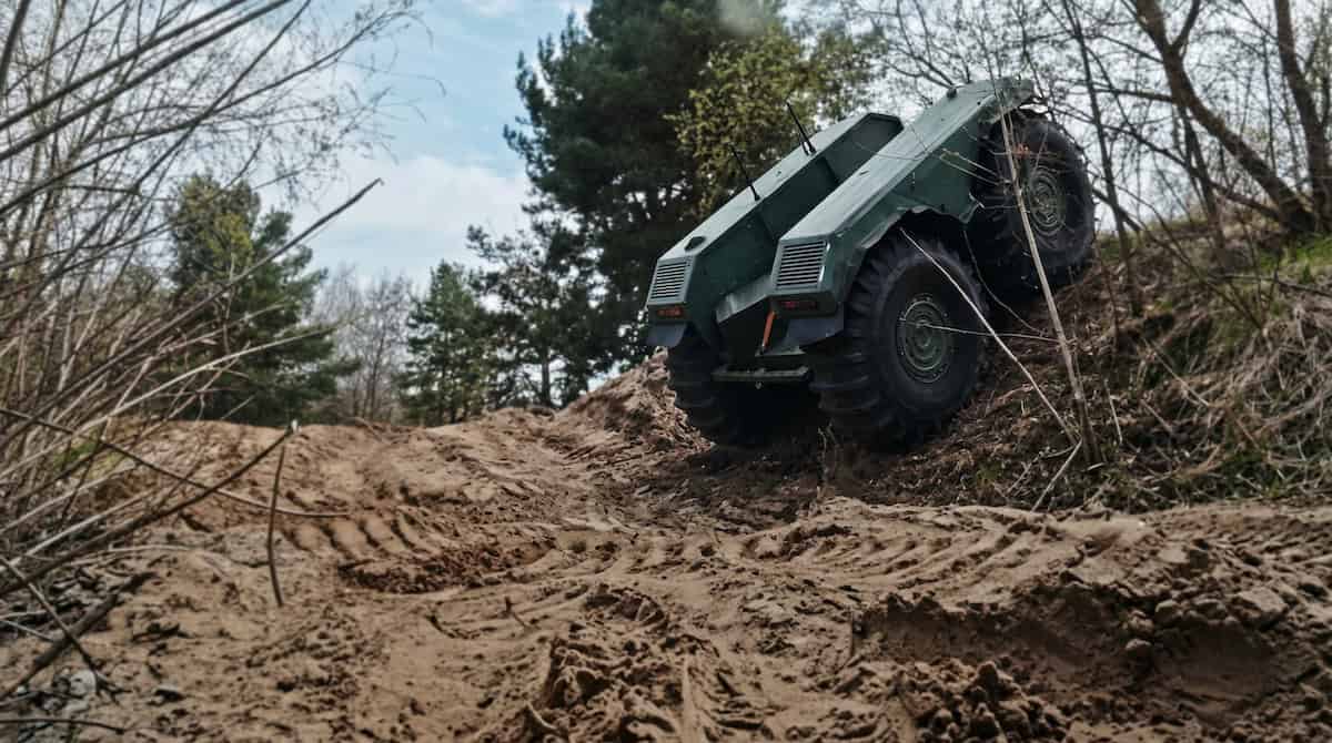
UNEX is a modular and amphibious UGV platform that can be equipped to serve a variety of logistics and humanitarian missions. It can be fitted with specialized equipment modules for strike missions, logistics, CASEVAC, ISR, counter-IED and mine clearance operations, firefighting and more.
The STANAG-certified vehicle is built for high-risk environments, with silent electric operation and ultra-low pressure tyres to minimise the risk of triggering explosives. Capable of surmounting obstacles of up to 1 meter in height, it operates seamlessly and reliably across mud, snow, ice and riverine conditions.
- Max payload capacity of 1700 kg
- Top speed of 20 km/h on land & 5 km/h in water
- 6 hours max endurance
Portable Charging Stations
Rugged & waterproof charging stations for challenging field environments

ABRIS’ range of Titanium power stations provides robust and reliable charging for UAV batteries and other essential equipment. With IP67-rated ingress protection, extreme durability, and shock-resistant design, they ensure energy independence under the most challenging of field conditions.

Titanium power stations are available in three variants, providing 1600, 3200, or 5500 Wh capacity.
Drone Management Software Ecosystem
IRIZI
Comprehensive drone management & mission planning software ecosystem

The IRIZI software suite provides a range of essential capabilities for drone operators and headquarters, combining operations planning, mission execution, and real-time coordination tools in a single intuitive interface. Providing AI-powered ISR data processing and threat identification, it enables interoperability between multiple UAV platforms, allowing the operator to maintain full situational awareness and control throughout the entire mission.
Components of the IRIZI software platform include:
- IRIZI Monitoring Center – a comprehensive C3 HQ solution that enables multi-project planning of unmanned operations, integrates GIS data, and provides real-time coordination through project management and multi-source video streaming.
- IRIZI ISTAR – a unified field-level software kit designed to coordinate multi-UAV operations, optimise missions based on terrain and threat data, and deliver full-cycle aerial photo and video processing with AI-powered target detection.
- IRIZI Ground – an intelligent control and automation platform for UGRS, enabling autonomous and coordinated operations with AI-driven mission logic, reliable performance in degraded environments, and an open, interoperable architecture.
Reviews
There are no reviews yet.